San Antonio’s 100 °F Days are Surging Faster than Climate Models Predicted
Bexar County’s extreme heat is accelerating past expectations. The Intergovernmental Panel on Climate Change (IPCC), an intergovernmental body of the United Nations, makes projections of the global climate based on alternative greenhouse gas scenarios. So, how do actual Bexar County temperatures match with these projections?
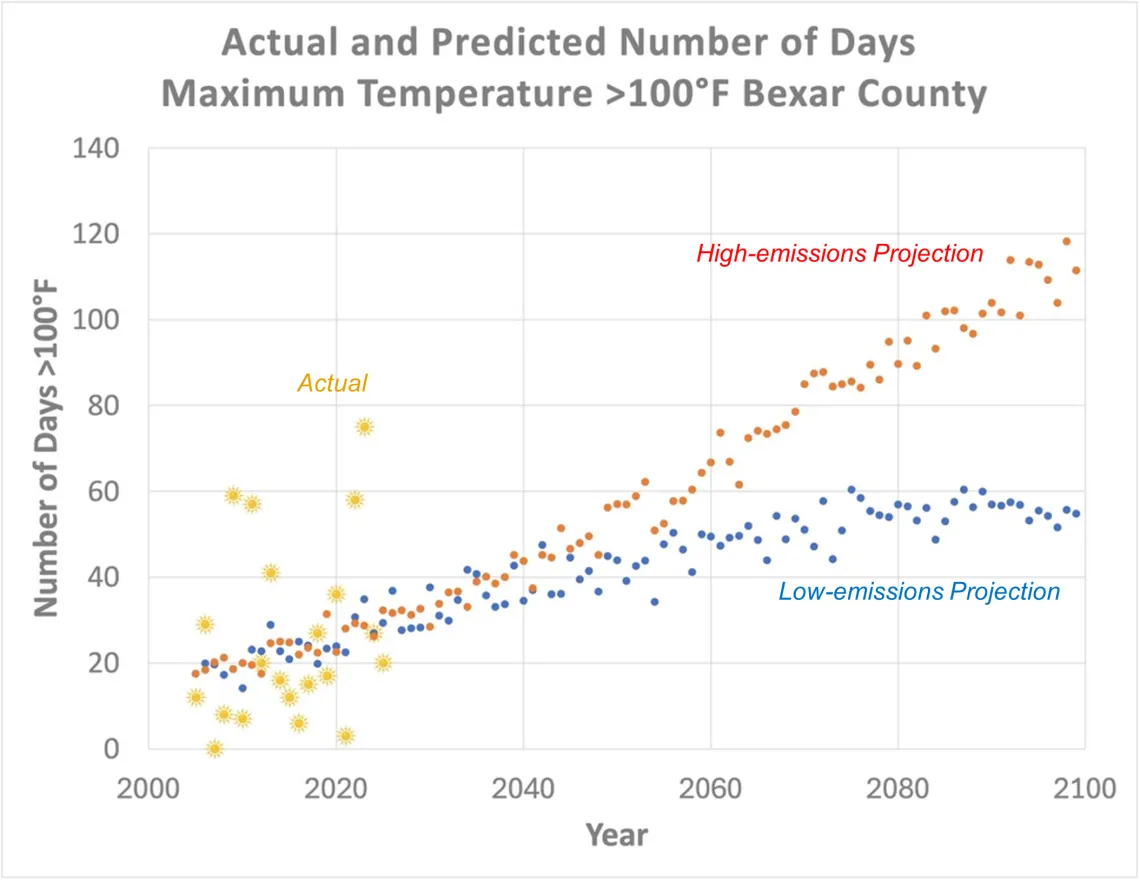
The online Climate Explorer, which provides federal climate projections, uses two main future scenarios, known as Representative Concentration Pathways (RCP) which are climate change scenarios to project future greenhouse gas concentrations. These projections have been formally adopted by the IPCC.
The two future scenarios shown in the graph are RCP4.5, a lower-emissions pathway where humanity moderately reduces fossil fuel use, and RCP8.5, a high-emissions “business-as-usual” future. Both scenarios predict steady increases in triple-digit days for Bexar County.
The two projections seem to go through the middle of the cluster of our actual Bexar County counts of annual days with the maximum temperature of at least 100°F. (Actual days can be found at the Extreme Weather Watch website.) It is hard to miss the data and projections for the extremely warm Bexar County year of 2023. The projections predicted 28.7 and 34.8 days of 100+ degree days, but the actual number was 75!
The takeaway? Extreme heat appears to be arriving sooner than expected, and San Antonio must accelerate both climate action and local heat adaptation.
by Bill Barker, Alamo Group executive committee member
Combining Historic Preservation with Green Building
What do you get when you try to combine historic preservation with natural building and permaculture? Jacqueline May, an Austin artist and environmentalist, will tell us at our November General Meeting.
Tuesday, November 18th
6:00 pm
Meeting schedule
| Informal get-to-know-you | 6:00 pm to 6:15 pm |
| Announcements | 6:15 pm to 6:30 pm |
| Featured program | 6:30 pm to 8:00 pm |
Venue
This is an in-person only meeting at:
William R. Sinkin Eco Centro, 1802 North Main Avenue
Map
Program topic
Austin artist and environmentalist Jacqueline May will introduce us to a solution that is a collaboration between a talented builder and the artist. The speaker has renovated an old rock house by combining historic elements with straw bale walls and cob, which is a material similar to adobe.
As it turns out, she is also a passionate gardener. She has developed a rain garden style that is beautiful, provides local organic food and, at the same time, reduces flooding, and purifies water with the use of fungi. So be sure to make the November meeting to see Jacqueline's slides of her beautiful stone house and surrounding native and food producing gardens.
The Alamo Group of the Sierra Club holds its general meetings the 3rd Tuesday of most months. They're always free and open to the public.
Multiple Piles of Nature Preserves, Downeast Maine
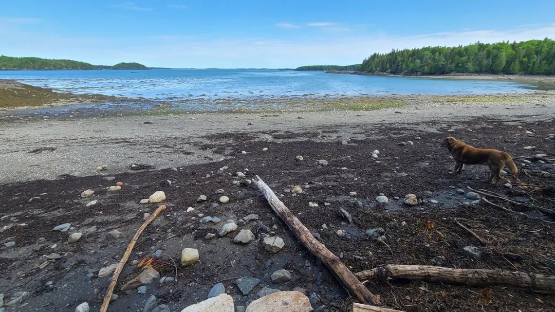
Again more spots most of us won't get to visit but hopefully the pictures and info bits are appealing. Didn't see many animals; bald eagles fledged by time we get there. Seen some herons along the river in front of house, but the summers are pretty warm. Seen a few foxes near the house, one running down a road after dropping a stolen chicken.
Downeast is an eastern bit of Maine, mostly along the Atlantic coast (Bay of Fundy and some Gulf of Maine) and an area including the easternmost point in the US. A Wikipedia article explains. There is an amazing large bunch of preserves in this area owned by a number of organizations. A couple such preserves owned by one of these, Maine Coast Heritage Trust, were mentioned in an article in this newsletter August 2025. The other organizations include Cobscook Shores and Downeast Coastal Conservancy (below), The Nature Conservancy, Maine Public Lands, Maine Inland Fisheries and Wildlife, and Moosehorn National Wildlife Refuge (January 2024).
Nothing like the downeast collection exists in Texas. Guessing a key factor in the creation of these preserves was the substantial decline in property values with the collapse of logging/sawmill/shipbuilding businesses. On a nature hike in Moosehorn a former superintendent said the railroad track that goes through the Baring division and along St. Croix River into Canada was abandoned around 1950; surely had been carrying lots of logs, lumber, cattle, seafood and essentials.
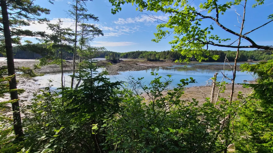
Just a few owned by Cobscook Shores and Downeast Coastal Conservancy
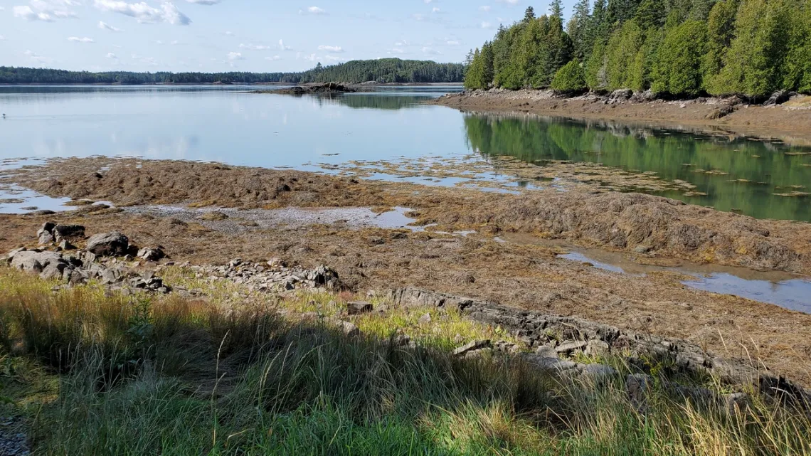
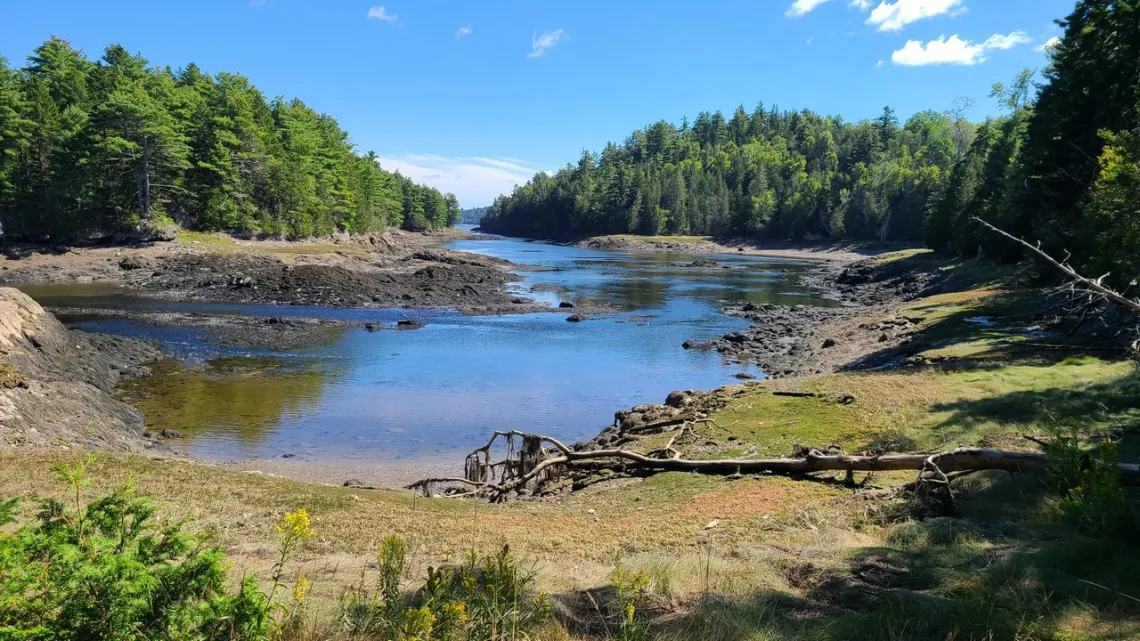
These preserves are on various bays and rivers which drain to Cobscook Bay which drains to Bay of Fundy. The first four pictures below are in Cobscook Shores preserves (link above). From their website: “Cobscook Shores is a series of twenty extraordinary new parklands nestled along the vibrant, eco-rich shores of Cobscook Bay near the historic town of Lubec, Maine. Situated in one of the most beautiful and pristine marine ecosystems on earth, the Parklands offer free public access for walking, picnicking, hiking, biking, camping and paddling in Cobscook Bay. … offers access to miles of undeveloped beaches, bluffs, coves and islands away from roads and automobiles. The system is unique on the East Coast of the United States for the miles of undeveloped shore front, incredible natural beauty, and dynamic tidal ecosystems. The parklands are privately owned by ... a family funded Maine charitable foundation.”
The easternmost spot in the US (February 2020) is in Quoddy Head State Park, just southeast of Lubec. Just east of Lubec is Campobello Island, New Brunswick, which includes Roosevelt-Campbello International Park (February 2025).
Cobscook Shores' PDF map is wonderfully detailed; here is the map and rules page. We can scroll around and see the twenty preserves, many of which have adjacent land or islands owned by the other organizations listed above. All are color coded and labeled by ownership. I complimented them on their really superb map.
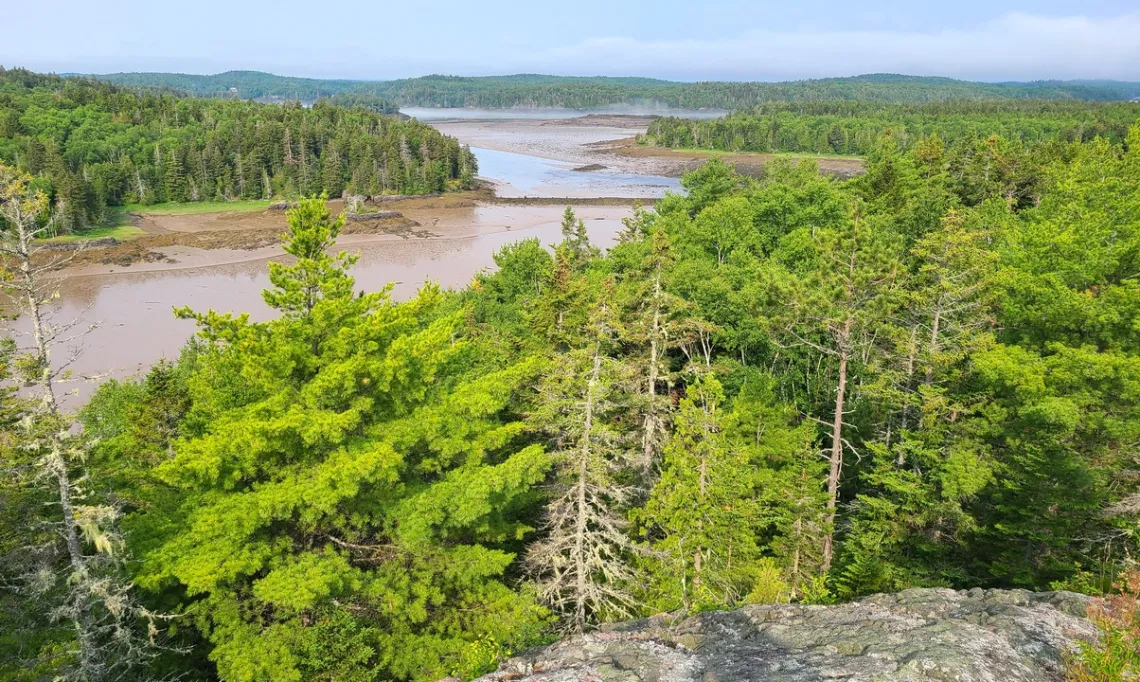
Just south of Black Duck Cove preserve saw the sign for Klondike Mountain preserve, owned by Downeast Coastal Conservancy. Climb a mountain? So did that a few days later. This “mountain” is about 120' climb and less than 2 miles total for all the trail bits, but there were a lot of basalt rocks and tree roots to climb over. This and the Black Duck Cove bits above will make sense if we look at the Cobscook Shores map.
by Kevin Hartley, Sierra Club Life Member
Outings: The Call of the Wild
Visit the Alamo Sierra Club Outings page on Meetup for detailed information about all of our upcoming Sierra Club Outings.
The Alamo Sierran Newsletter
Richard Alles, Editor
Published by the Alamo Group of the Sierra Club, P.O. Box 6443, San Antonio, TX 78209, Website.
The Alamo Group is one of 13 regional groups within the Lone Star Chapter of the Sierra Club.
Changed your contact information?
If you're not sure whether the Sierra Club has your current email address, send an email to Member Services with your name and address and/or member ID (see Locating Your Member ID) so they can add your email address to your member record.
Have you moved? Let us know by sending your old address, your new address and your member ID to: address.changes@sierraclub.org.
Go online for the latest news and events
 |