Maine Coast Heritage Trust, Just a Couple Preserves
From the website, initial page: "192,500 acres conserved with partners, 339 coastal islands protected with partners, 165 MCHT preserves open to the public, 106 miles of trails to explore”. Lots of appealing info on from the Conservation Work page. There are other land trusts such as this, many likely originating with private funding after the decline in rural property values due to fading lumbering, shipbuilding and fishing industries.
On the About page there is info about volunteering and the origin of MCHT in 1970. If my wife and I had known more might have moved here in 1998 when I retired and bought some lovely property with a nice house for peanuts compared to values then in most of Texas. And would have done volunteer work in preserves.
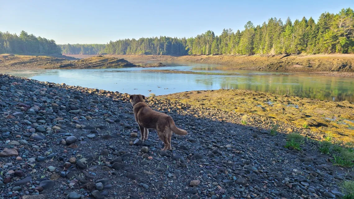
On the Preserves page there is a map with a link to each one. There are pages for preserves by area; half of the 21 Downeast Preserves are easy drives from our summer place in Pembroke. From the latter page: “In Maine’s easternmost county [Washington], MCHT owns and manages vast and extraordinarily beautiful stretches of Bold Coast, as well as preserves in and around Cobscook Bay. You can hike trails for miles or pass an afternoon on a cobble beach, looking out for whales.” Just a couple preserve examples below. As always when walking around such places we can realize we only see a fraction of what we think we are looking at and and understand only a tiny fraction of even that.
No camping on the preserves but there are state parks and private campgrounds, driving to some of these preserves I go past Cobscook Bay state park. And there are Maine public reserved lands, some of which have campgrounds and at-large campspots. In the September 2017 issue of this newsletter there was an article about Bigelow Preserve PRL (for example, though way to the west), which has campgrounds.
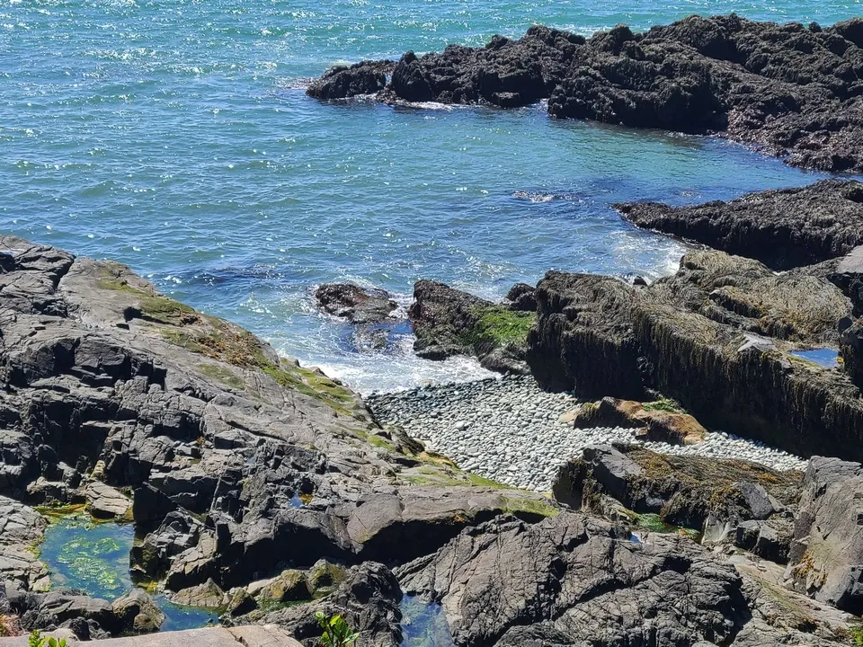
Sipp Bay Preserve
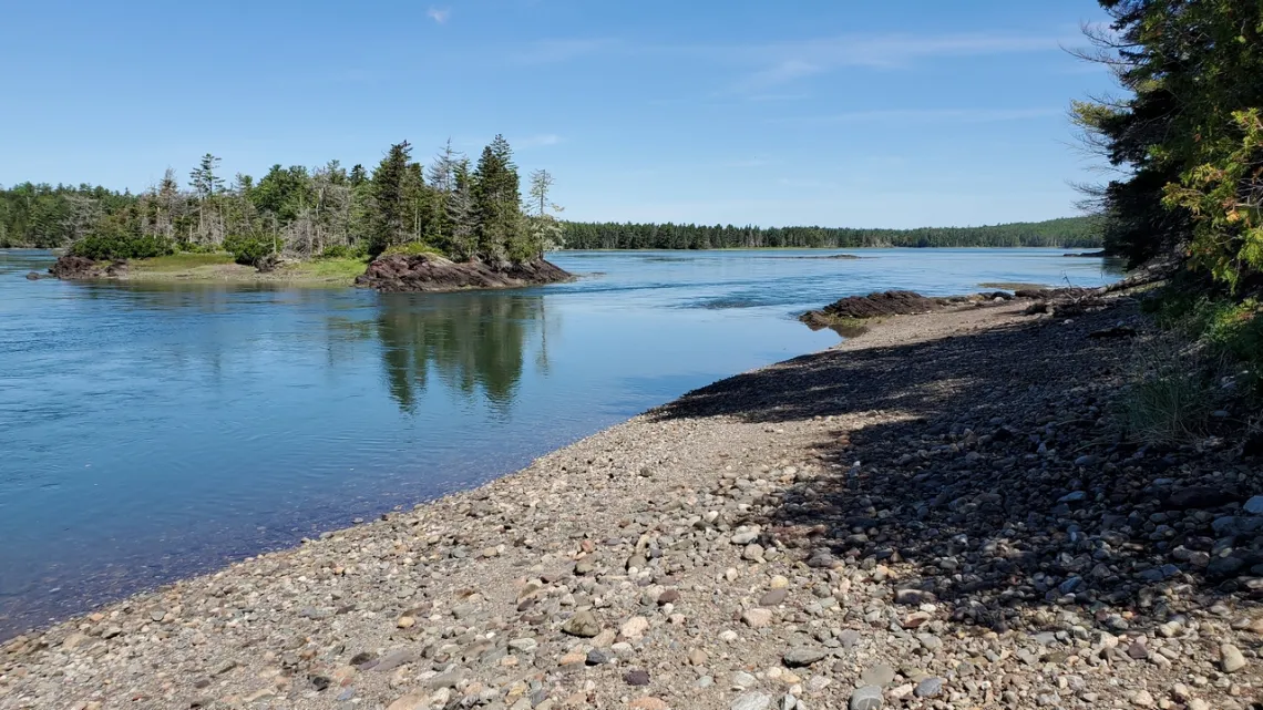
This one is just east of Pembroke, 15 minute drive from our summer house. From the Sipp Bay page reached from the Downeast Preserves page we can see a map showing the two short loop trails which I have done like ten times. The trails are in good shape and mostly level; with low tide we can walk along much of the water's edge. Surely best to carry binoculars and have access to bird/plant identification apps. On the map we can see an island just west of a little western peninsula, apparently not in the preserve, though there is a nice trail across the center. At low tide we can easily get to that island and walk around it (first picture).
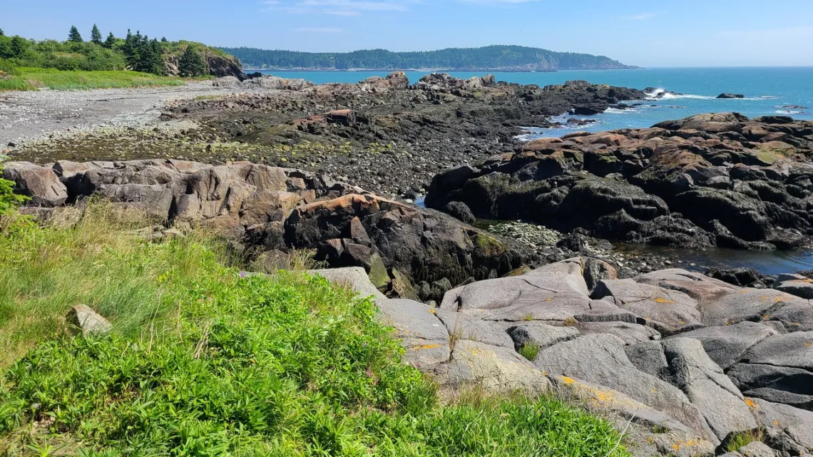
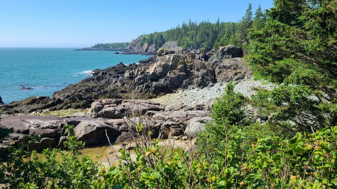
Bog Brook Cove
Here's the preserve page, is about 40 minutes drive from the house. May have only been here once, last year. The pictures below, taken July 2024, may be from Chimney trail. I should go back and do this one again; the inland trails would be entertaining of course, though we likely imagine the seaside vistas are more appealing.
What lies beyond the horizon?
Further to the captions of pics below. If inclined we might pull up an online map and do bearings/distances between spots mentioned. And see possibly other interesting spots (eg Cape Split Provincial Park, Nova Scotia, on a peninsula due W of Burntcoat Head (see caption in next photo). Fantastic even though didn't do the whole peninsula loop trail, but can't find my pictures.
Seaweed, another free super-sustainable vegetable!
In the second picture we can see a bunch of seaweed ready for a bit of harvesting. Extensive info at TheAlgaeHunter.com. Other info easily found about nutritional benefits. I easily collected some on the coast not far east couple years ago. Little risk of heavy metals/plastics contamination which might be present on the Texas coast. Pretty tasty sauteed with garlic, vinegar, herbs, seasoning. Will do this again summer 2025. This bit is further to an article in April 2025, Super Benefits of Cultivating/Consuming Nopalito! That vegetableis easily grown and harvested in the south Texas, though not in Maine.
by Kevin Hartley, Sierra Club Life Member
The Edwards Aquifer – The Geology, Hydrology, and Ecology of this Unique Aquifer System
Our August general meeting features Brent Doty, P.G., Research Manager, Edwards Aquifer Authority.
Tuesday, August 19th
6:00 pm
Meeting schedule
| Informal get-to-know-you | 6:00 pm to 6:15 pm |
| Announcements | 6:15 pm to 6:30 pm |
| Featured program | 6:30 pm to 8:00 pm |
Venue
This is an in-person only meeting at:
William R. Sinkin Eco Centro, 1802 North Main Avenue
Map
Program topic
The Edwards Balcones Fault Zone Aquifer is one of the most prolific karst aquifers in the world. Brent will discuss the geologic, hydrologic, and ecological characteristics of the Aquifer that make it so unique and critical to both the communities and ecosystem it serves.
About our speaker
Research Manager for the Edwards Aquifer Authority’s Aquifer Science and Modeling Team, Brent Doty is a geoscientist with more than 16 years of experience in hydrogeology and water resources management. Brent is a licensed professional geoscientist in Texas and holds an M.S. in Natural Resources Management and a graduate certificate in Water Conflict Management and Transformation from Oregon State University.
Brent’s role includes the development and execution of several research initiatives to better understand the Edwards Aquifer System and to provide decision makers with the best available science to manage, enhance, and protect the Edwards Aquifer System. Brent has worked on several key initiatives, including surface and groundwater interactions, aquifer vulnerability assessments, and emerging contaminant studies. Much of his current work focuses on quantifying the potential benefits of nature-based land management solutions as a managed aquifer recharge project.
Brent is also the lead geologist responsible for assessing potential conservation easement properties for the City of San Antonio’s Edwards Aquifer Protection Program, a 300 million-plus dollar conservation initiative that has protected more than 180,000 acres of environmentally sensitive land over the Edwards Aquifer Recharge and Contributing zones.
The Alamo Group of the Sierra Club holds its general meetings the 3rd Tuesday of most months. They're always free and open to the public.
Why We May Feel Hotter Than the Temperature
If you have felt like recent summers are hotter than ever before, you are absolutely right and not just because of the thermometer readings. Human bodies respond to a combination of four key factors: air temperature, humidity, radiant heat (e.g., direct sunshine), and wind speed. Together, they determine how hot it feels, and how dangerous the heat is.
Humidity slows the evaporation of sweat, our main cooling method. High humidity means sweat just sits on our skin, keeping us hot. Radiant heat, like direct sunlight on your skin or the ground around you, adds extra heat. A breeze can cool us off by evaporating sweat and moving hot air away. All these factors combine to create a heat stress measure known as Wet Bulb Globe Temperature (WBGT). This differs from the heat index, which takes into consideration temperature and humidity and is calculated for shady areas.
WBGT was developed in the 1950s by the U.S. military, specifically by researchers at the U.S. Navy and U.S. Army to protect service members from heat illness and death during training and operations.
WBGT is still used by the military. Agencies like OSHA (Occupational Safety and Health Administration) and NIOSH (National Institute for Occupational Safety and Health) reference WBGT in workplace safety guidelines. Sports leagues, especially at the collegiate level, use it to cancel or modify practices during high-heat periods. The National Weather Service is experimenting with ways to estimate WBGT for a selected location.
Here in San Antonio, the official temperature is recorded in the shade at the airport, over grass with good airflow. But on a sunny sidewalk downtown or a bus stop near asphalt, conditions are usually hotter. The photo below of a WBGT meter was taken in the afternoon at the Alamo on August 16, 2023, when the official San Antonio temperature was 103°F. The meter measured the air temperature at 106°F, the relative humidity at 30%, and the WBGT at 87.4°F. It is recommended that a working or exercising person spend no more than 30 minutes in the direct sun if the WBGT reading is 85-88°F.
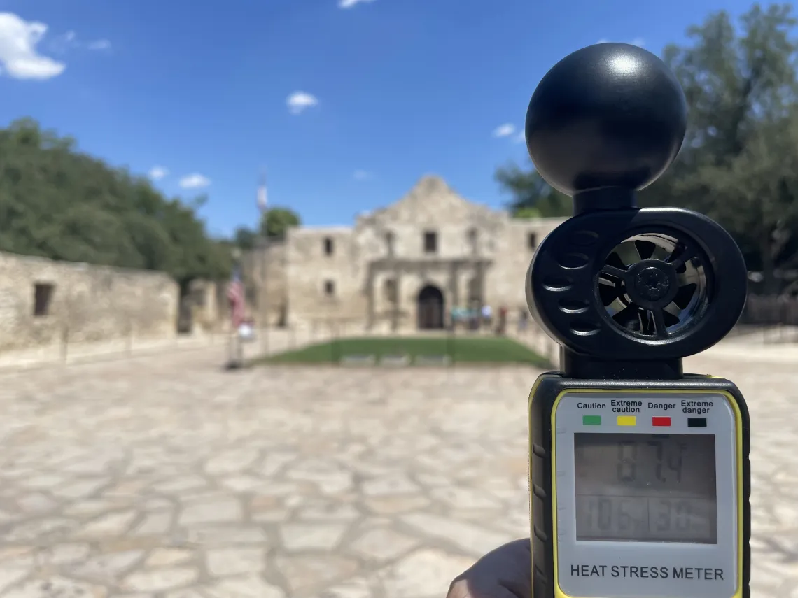
Photo by Bill Barker
For the first time in human history, we are seeing WBGT levels that exceed what people have ever experienced. The highest WBGT that humans can survive when exposed to the elements for at least six hours is about 95 degrees F. In some parts of the world, conditions have already reached or passed the limits of human survivability.
Understanding WBGT helps us advocate for shaded trails, reflective overhead surfaces, urban trees, and better design. It may be worth encouraging local agencies or universities to deploy WBGT sensors at public spaces like parks, construction zones, and schools. Extreme heat is no longer a future concern: it’s here now, and it’s a challenge we must meet together.
by Bill Barker, Alamo Group executive committee member
Outings: The Call of the Wild
Visit the Alamo Sierra Club Outings page on Meetup for detailed information about all of our upcoming Sierra Club Outings.
The Alamo Sierran Newsletter
Richard Alles, Editor
Published by the Alamo Group of the Sierra Club, P.O. Box 6443, San Antonio, TX 78209, Website.
The Alamo Group is one of 13 regional groups within the Lone Star Chapter of the Sierra Club.
Changed your contact information?
If you're not sure whether the Sierra Club has your current email address, send an email to Member Services with your name and address and/or member ID (see Locating Your Member ID) so they can add your email address to your member record.
Have you moved? Let us know by sending your old address, your new address and your member ID to: address.changes@sierraclub.org.
Go online for the latest news and events
 |