What is Groundwater?
As its name might suggest, groundwater refers to water that seeps into the ground and is held by an assortment of geologic features such as soils and rock crevices. Sandstone and limestone are commonly found throughout Texas and allow for the creation of large underground reservoirs of groundwater or aquifers. In Texas, the type of rock is one of the main factors in determining how and where groundwater will seep into the earth's surface.
Why Does Groundwater Matter?
Groundwater in Texas, which includes water in aquifers, accounts for 55% of the state's water consumption. Both aquifers and groundwater support a network of natural springs which feed water to iconic rivers like the Guadalupe and Frio, along with swimming holes like Barton Springs in Austin and Balmorhea in West Texas, which is the largest spring-fed pool in the world. Aquifers provide clean groundwater for cities like San Antonio, El Paso, Houston, as well as a number of unincorporated areas. Texas groundwater is a crucial resource for the ecosystems, industrial uses as well as our daily lives. The agricultural industry in Texas uses the largest percentage of the state’s groundwater supply for irrigating crops, cities require water to support their populations and infrastructure, and the rivers and creeks around Texas rely on this same groundwater to propel their natural cycle. Without proper groundwater management, all these entities are put at risk.
Groundwater Law in Texas
The first laws surrounding groundwater in Texas came about in the early 1900s when the sprawl of railways increased the demand for water. Railways required water for the steam driven engines and in order to increase availability, the Houston & Texas Central Railway drilled a well which soon pumped around 25,000 gallons a day. This massive withdrawal from the water table caused the wells of neighboring landowners to run dry. A court ruled in favor of the railroad and upheld what is known as the “capture rule” stating landowners have the right to capture an unlimited amount of groundwater from aquifers and artesian wells regardless of the effects it has on neighboring water supplies. This practice was sufficient when neighboring landowners were capturing small amounts of water for similar uses, yet, as demand increased, the capture rule became hard to regulate and ineffective at protecting the water table and groundwater supply.
In 1949, Texas created Groundwater Conservation Districts (GCDs), which have the authority to modify the rule of capture depending on a district’s circumstances. Before these districts were created, there was no enforcing body to prevent the over-drafting of groundwater. In 2002 the Texas Water Development Board (TWDB) created Groundwater Management Areas (GMAs) "in order to provide for the conservation, preservation, protection, recharging, and prevention of waste of the groundwater, and of groundwater reservoirs or their subdivisions, and to control subsidence caused by withdrawal of water from those groundwater reservoirs or their subdivisions.” The GCDs were then placed within the 16 GMAs. In 2005, the Texas Legislature created the Groundwater Management Area Process (GMAP) to allow for more coordination between districts with shared aquifers.
Who regulates Texas Groundwater?
Texas groundwater is currently regulated by approximately 100 Groundwater Conservation Districts (GCDs) with 61 single-county districts and 39 that cover more than one county. One of the main duties of GCDs is to regulate spacing and production of wells to ensure that groundwater is not being over-drafted at rates that would deplete the aquifer. However, GCDs only regulate groundwater withdrawals of more than 25,000 gallons a day and are limited to managing areas within the district's boundaries, leaving 11% of the state with no groundwater management authority. The Red Sands GCD, located near the southern tip of Texas, is the smallest district, covering 114 square miles, with the largest and oldest district being the High Plains Underground Water Conservation, created in the Texas Panhandle in 1951, covering 12,000 square miles. The Texas Water Development Board website has a downloadable map of Texas groundwater districts.
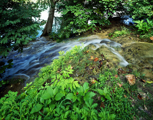
Groundwater and Surface Water
Groundwater and surface water represent two stages in the water cycle which are very closely related yet have some key differences. Surface water is water that flows through rivers, streams, and creeks or is impounded in lakes or reservoirs. Groundwater is water that has seeped into the earth to become part of the water table or is further filtrated into an aquifer. Groundwater can also naturally discharge back into a creek or river to become surface water and vice versa. The relationship between groundwater and surface water has been studied in great detail, yet Texas water law does not address the interconnectivity of the two, and instead manages them as separate water sources. During periods of low rainfall or drought when surface water is not being readily replenished, springs or the underflow of groundwater from aquifers can support the surface flows of creeks and rivers.
Examples of surface water and groundwater interconnectivity:
- Data from the Unites States Geologic Study (USGS) shows that 86% of the water flowing through the Guadalupe River near Victoria originated from upstream springs in San Marcos.
- In the Panhandle, small streams continue to flow even during prolonged periods of drought due to groundwater from the Northern Ogallala Aquifer which spans the Great Plains from Nebraska to the Panhandle. As reported by Bloomberg, “The Ogallala aquifer lies under eight states from South Dakota to Texas. If it were above ground, its 174,000-square-mile surface area would be nearly double all five Great Lakes. About one-fifth of all U.S. cattle, corn, cotton, and wheat depend on the Ogallala. A 2012 USGS survey study estimated will lose irrigation capacity on 35 percent of the land in the next three decades.”
- On the Edwards Plateau, natural discharges from the Trinity Group Aquifer form the headwaters of the Pedernales and Blanco Rivers.