Last month, in our first article, we discussed why nature matters more than ever. This month we’ll focus on how sea level rise will impact each shoreline differently.
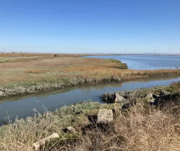
Statewide flood projections don’t take local conditions into account. Local social, geographic, geologic, and hydrologic characteristics can significantly influence the nature of the threats to a given community. We need to be thinking about their unique shorelines and taking inventory of the circumstances to be better prepared.
Here are some factors that can alter how severely sea level rise impacts a certain shoreline.
- Subsidence
Subsidence is the sinking or gradual lowering of Earth’s surface. This rate differs from point to point along the bayshore. For example, a recent study by NASA’s jet propulsion lab found that several cities across the Bay, such as Foster City, are experiencing subsidence at an increased rate of 0.4 inches per year, which means in 10 years, the ground will sink 4 inches. This is partially due to Foster City being built on bayfill, and the Bay is trying to reclaim that land. This sinking coupled with rising tides heightens the risk of severe flooding. - Sub-surface Saltwater Infiltration
As sea levels rise, salt water doesn’t only move across our surfaces. It also moves inland underground, interacting with underground infrastructure such as pipes, sewage systems, contaminated sites, and building foundations. Salt water can corrode this critical infrastructure, and pose issues to the structural integrity of these systems. - Groundwater Depth
The dense salt water also pushes underground freshwater aquifers toward the surface, increasing emergent flooding. It’s critical to note this occurs regardless of the presence of engineered solutions, such as levees or sea walls. - Liquefaction
Rising groundwater tables can also impact soil stability, making our shorelines more vulnerable in earthquakes or other seismic events. A study by USGS notes areas in the San Francisco Bay built on bayfill are of particular risk for heightened liquefaction.
The unique geology, hydrology, and subsurface infrastructure in each city must be considered to develop effective sea level rise adaptation strategies. It is important that cities are researching their own shoreline, rather than relying on regional projections that may not take into account all factors, in order to better understand how these factors will change through time, and ultimately impact community members.
In our next article in the series, we’ll discuss groundwater rise, mobilization of contaminants, and environmental justice.
Until then, you can help us keep the Bay alive! Learn how you can take action or join the campaign.
This is your time, working with local communities, to help keep the Bay alive. Sea level rise is an active planning challenge confronting every Bay shoreline community. In this series of articles we’ll highlight the Bay Alive Campaign’s commitment to preserving and restoring our natural Bay ecosystems, promoting the implementation of nature-based solutions, evening the playing field by advancing environmental justice, and addressing shoreline contamination by cleaning up toxic sites on the Bay. We’ll address the policy moment we helped create, why informed, local leadership is essential to turning strong standards into real, resilient outcomes, and the many ways you can help shape the Bay’s future.