Last month, we discussed why it matters how and when we adapt to sea level. This month, we’ll focus on one of the most important tools now guiding that work: the Regional Shoreline Adaptation Plan (RSAP).
A Baywide Problem Needs a Baywide Plan
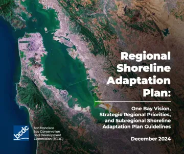
The San Francisco Bay shoreline crosses dozens of city and county boundaries, but sea level rise does not stop at jurisdiction lines. Water moves across borders. Wetlands, wildlife, groundwater, contamination, and flood risk are all connected. A decision made in one city can affect neighboring communities, nearby habitats, and the health of the Bay as a whole.
For years, sea level rise planning around the Bay has been fragmented. Some cities have done significant work, while others are just beginning. Some projects have looked only at one property, one neighborhood, or one shoreline segment, without fully accounting for impacts on the broader Bay system. Planning for our interconnected future requires a coordinated approach based on a shared framework of priorities.
That is where the RSAP helps.
In 2023, the California Senate passed SB 272, a state law requiring Bay shoreline jurisdictions to prepare sea level rise adaptation plans. In response, the Bay Conservation and Development Commission (BCDC), developed the RSAP to guide that process. Adopted in 2024, the RSAP sets regional expectations for how local governments should plan for rising seas.
What the RSAP Changes
The RSAP is important because it does more than tell cities to plan; it helps define what good planning should include.
At its core, the RSAP recognizes that the Bay is not just scenery, it is essential resilience infrastructure. Healthy wetlands, mudflats, beaches, oyster reefs, eelgrass beds, and shallow-water habitats help absorb wave energy, reduce flooding, filter pollution, store carbon, support wildlife, and protect nearby communities. If we lose those ecosystems, we lose one of our strongest defenses against sea level rise.
The RSAP also reflects a major shift in how the region thinks about adaptation. Instead of treating sea level rise as a series of isolated engineering problems, it encourages cities to plan holistically. That means looking not only at local flood risk, but also at regional impacts, groundwater rise, contamination, habitat migration, environmental justice, and long-term shoreline change.
Essentially, the RSAP tells cities to plan cooperatively, treat the Bay as a complete entity, allow nature to suggest solutions before resorting to walls, pay attention to hidden groundwater rise and contamination risks, and include vulnerable communities in decisions that shape their future.
This matters because local choices accumulate. A seawall in one place can increase flooding or erosion somewhere else. New development in a vulnerable shoreline area can reduce the space available for future adaptation. A plan that ignores rising groundwater may miss serious risks to homes, roads, utilities, and contaminated sites. A process that fails to meaningfully involve vulnerable communities can reinforce the same inequities which sea level rise is likely to worsen.
The RSAP gives cities a common starting point for avoiding those mistakes. It sets the regional framework, but the work of applying that framework will happen locally, city by city and shoreline by shoreline.
Why Timing Still Matters
Bay shoreline jurisdictions have until 2034 to complete their sea level rise adaptation plans, but that deadline should not create a false sense of time. Sea level rise impacts are already evident during king tides and storms, contributing to shoreline flooding and erosion, while rising groundwater is creating additional risks below the surface. Meanwhile, cities are making decisions now about development, infrastructure, zoning, capital improvements, habitat restoration, and flood protection, without having completed their comprehensive sea level rise adaptation plans.
Early planning matters because it preserves choices. The sooner communities understand their risks and identify adaptation pathways, the more options they have. Waiting longer can leave cities with fewer tools, higher costs, and more pressure to rely on reactive hard armoring because the space for nature-based or phased solutions has already been lost.
At the same time, the RSAP is not a one-size-fits-all plan since every shoreline is different. Local geology, groundwater conditions, contamination risks, habitat types, development patterns, infrastructure, and community needs all vary. That is why local planning is necessary, but local flexibility works best when it is guided by clear regional principles: protect people, protect ecosystems, prioritize nature-based solutions where feasible, address contamination, plan across boundaries, and avoid choices that make future adaptation harder.
That is the promise of the RSAP; it gives the Bay Area a shared vision and a strong set of standards for turning sea level rise planning into long-term resilience. In future articles, we’ll look more closely at the adaptation opportunities available to local communities and how residents can help ensure that strong regional standards become real-world results, for their community and the entire Bay Area.
Until then, you can help us keep the Bay alive by learning more about the RSAP and why it matters for your shoreline community. Learn more, take action and/or join the campaign.