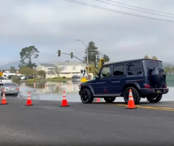
San Francisco Bay is experiencing unusually high water levels this fall, and some of the highest tides of the year are still ahead. This winter, a powerful El Niño, oceanic Kelvin waves, and seasonal king tides are combining to increase the potential for shoreline flooding, especially if winter storms arrive at the same time.
Whether you're curious about these natural phenomena or want to see what rising seas could mean for your community, the upcoming king tides offer an opportunity to observe the Bay at unusually high water levels.
When Are the King Tides?
The California Coastal Commission has identified three major king tide periods this winter:
- November 24–26, 2026
- December 23–25, 2026
- January 21–22, 2027, with some additional dates in Northern California.
High tides arrive at different times around the Bay, generally occurring later as the tidal wave travels into the South Bay.
The table below provides predicted high tide times for selected locations along the San Mateo and Santa Clara County shorelines. It shows one representative day from each king tide period.
Predicted Peak High Tides Around San Francisco Bay
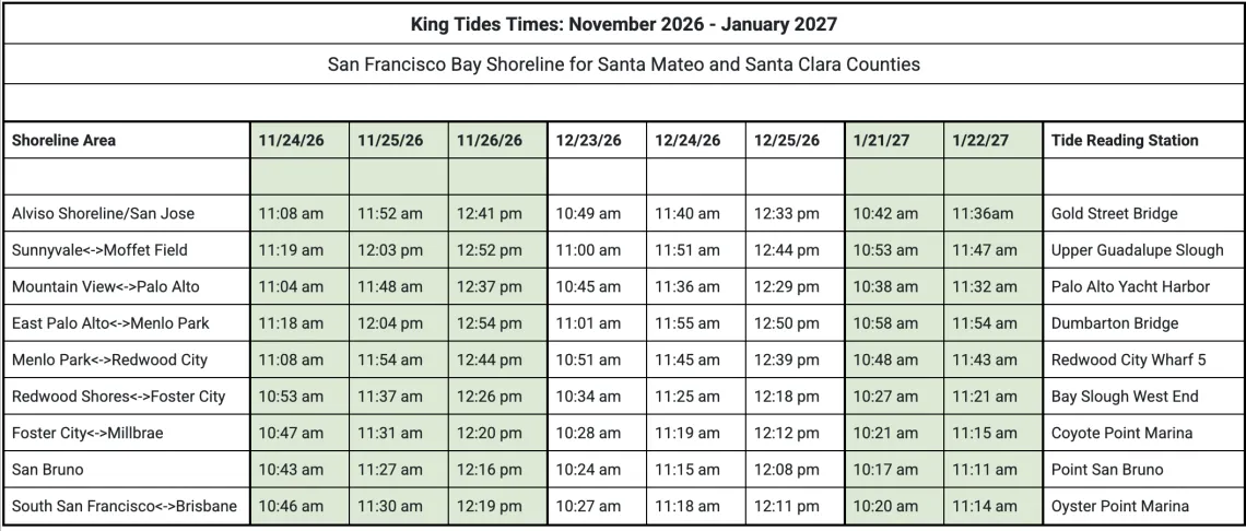
Check NOAA Tide Predictions and the California King Tides Project for updated local information.
Times are local (Pacific Standard Time), based on the tide predictions compiled for this article. They indicate when high tide is expected, not whether flooding will occur. Check NOAA Tide Predictions for updated predictions at specific locations and on other dates.
Why Are Water Levels So High?
King tides are the highest naturally occurring tides of the year, produced by the gravitational alignment of the sun, moon, and Earth. Their timing can be predicted years in advance.
This year, two related ocean phenomena are raising the stakes.
A strong El Niño is warming tropical Pacific waters and influencing weather patterns. Meanwhile, Kelvin waves, enormous, slow-moving pulses of warm water, are traveling across the Pacific and along the West Coast, temporarily raising coastal sea levels. NOAA reports that these overlapping conditions have already contributed to exceptionally high water levels and flooding in California.
Storms can make matters worse. Wind and low atmospheric pressure can push water higher, while heavy rainfall may overwhelm drainage systems when high Bay waters prevent runoff from flowing freely into the Bay.
See the King Tides for Yourself
Visit a familiar stretch of shoreline near the predicted high tide and notice where water reaches trails, roads, wetlands, and developed areas. Take photographs from safe public locations, and consider returning during an ordinary tide to compare conditions.
You can also contribute your photographs to the California King Tides Project, helping scientists and communities document changing coastal conditions.
Please put safety first. Check local flood advisories and closures, stay out of floodwater, avoid unstable or submerged pathways, and give shoreline wildlife plenty of space.
A Glimpse of Our Bay's Future
King tides are more than a seasonal curiosity. They offer a preview of water levels that will become increasingly common as seas rise. But some of the greatest threats to our communities and the Bay's ecosystems aren't visible during a high tide.
Read our companion article, King Tides Show Us the Future, But They Don’t Tell the Whole Story, to learn what rising seas mean for our shorelines and how Sierra Club's Bay Alive Campaign is working to help communities prepare.