July 18, 2023
Ms. Amy Chen
Community Development Director
City of East Palo Alto
Via email to: achen@cityofepa.org
Re: Ravenswood Business District/4 Corners Specific Plan Update
Dear Ms. Chen,
The Sierra Club Loma Prieta Chapter’s Bay Alive Campaign, Citizens Committee to Complete the Refuge, Green Foothills, and Sequoia Audubon Society are pleased to submit these comments regarding recent revisions to the Ravenswood Business District Specific Plan Update (RBDSP) framework. Our organizations work to enhance sea level rise resilience and to protect wetlands, open space, wildlife habitat, and other ecological and natural resources in the Bay Area. We collectively represent thousands of members in and around East Palo Alto who care about open space and nature as well as the communities that support them.
We commend the diligent work of City staff and its team of consultants to develop a thoughtful plan for the future of the RBD/Four Corners area and the City. We are particularly pleased to see that the RBDSP updates include protection of the public and private wetlands at the north east edge of the plan area. Reduced floor area ratios and the inclusion of stepped-back building heights and transition zones next to residential and shoreline areas are steps in the right direction, but do not allay all of our concerns. Please see our comments below regarding the recent plan updates as well as some continuing concerns regarding chemical hazards and community outreach.
Wetlands, Waterfront Promenade, and Levee Alignment
As noted above, we strongly support long term protection and restoration of both public and private wetlands. We look forward to learning more about what mechanisms will be used to put them under “long-term management.”1
We also support placing the waterfront promenade in the northeast corner of the Plan area well inboard of the current Bay Trail and tying it into the SAFER levee design as shown in figure 1-5 (Public Parks and Open Space Network).2 That alignment would offer invaluable resiliency benefits by providing substantial space for natural flood protection in tidal marsh areas and creating space for wetland migration as sea level rises. We encourage further conversation with Midpeninsula Regional Open Space District to assess the need and potential to introduce additional tidal flows into the wetlands between the Bay Trail and the waterfront promenade/levee.
Setbacks, Building Heights and Transition Zones
We were pleased to see that the proposed RBDSP updates establish a building setback to assure no development within the Bay Conservation and Development Commission’s (BCDC) 100-foot band. We also appreciate the inclusion of stepped-back building heights to create transition zones next to residential and shoreline areas. We are concerned, however, that for the shoreline parcels at the end of Bay Road, the location of the existing BCDC band relative to property lines effectively eliminates the first (64-foot) stepback in that area, allowing 96-foot tall buildings immediately adjacent to open space.3 That, combined with a concentration of the Plan’s tallest allowable height buildings in the same vicinity, undermines the goals of reducing height and massing impacts on sensitive Bayland habitat and preserving the critical view corridor along Bay Road.
We would like to see you address this stepback anomaly at the end of Bay Road and we hope that the RBDSP also will include robust bird safe design4 and dark sky standards5 to further reduce impacts on neighborhoods, wildlife and Bay ecosystems. Finally, although Figure 1-3 (Required Stepbacks and Height Transitions)6 identifies three desired view corridors, neither Figure 1-3 nor Figure 1-2 (Maximum Building Heights)7 show heights, setbacks or stepbacks that would protect those views for the community. We look forward to learning more about the “minimum building separation standards'' mentioned in the staff report and how those view corridors will be protected.8
Soil Stability, Contamination Hazards and Stormwater Management
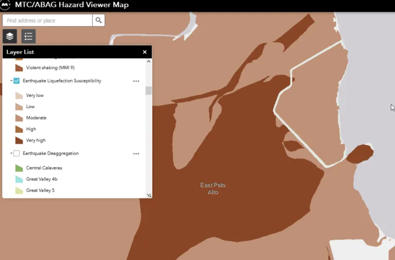
Soil stability is of significant concern for the RBD area, which has been classified by the Metropolitan Transportation Commission/Association of Bay Area Governments (MTC/ABAG) as having moderate to very high liquefaction susceptibility.9 Sea level rise effects on shallow groundwater conditions could further complicate soil stability and also spread soil contamination more widely. Additionally, taller buildings may require very deep pilings that would be incompatible with existing contamination containment caps and could provide a conduit for hazardous vapors to migrate from deep aquifers to the surface.
We were pleased to hear from Raimi & Associates that a consultant has been hired to perform an area-wide hazards and groundwater study. Can you provide any further detail about the scope of work for this study and expected timing for completion? We believe that the study should include evaluation of not only groundwater, but also soil stability and contamination hazards.
East Palo Alto residents frequently comment about the threat of legacy contamination within the RBDSP area. We share their concern. The potential for mobilization and spread of hazardous chemicals from legacy contamination in the Plan area could have significant site-specific and cumulative impacts. In addition to risks associated with current conditions, we note that sea level rise, shallow groundwater rise, and fluvial flooding threaten to exacerbate any hazardous material impacts associated with new development in the area, potentially spreading contamination more widely than anticipated under current conditions.10 11 Also, new project sites that use raised pads to counter sea level rise may have an unfortunate impact on lower-lying existing residential areas because rising groundwater will migrate to emerge at the lower areas and accumulate there, thus creating added flooding risks over time.
Whether required by CEQA or not, we urge the City to provide a full assessment of contamination risks in the Plan area, including those associated with shallow groundwater rise and climate-related flooding. Known contamination should prevent the construction of any building until the hazards are fully remediated and mobilization of contamination, including from future flooding and shallow groundwater rise, is determined not to be a risk. Additionally, a programmatic EIR, by its nature, defers much analysis to future project-by-project environmental review, often with less public visibility and engagement, and limited assessment of cumulative impacts. We hope the RBDSP will include robust policies that require full remediation and ensure ongoing transparency regarding monitoring, management, and mitigation of all future project-specific and cumulative contamination impacts based on then-current conditions, as the Plan unfolds over time.
Finally, we also remain very concerned about the inadequacy of the storm drain system. Please ensure the Stormwater Master Plan update and funding mechanisms are in place prior to issuance of development entitlements.
Community Outreach
We urge you to strengthen your community outreach strategy for review of the upcoming public Draft RBDSP and Environmental Impact Report. This is a complex plan with major implications and impacts for the community, and prior to the City’s April 2023 joint study session it had been nine months since the last public dialogue about the RBDSP. The proposed community engagement activities, including a series of small group stakeholder meetings and a single survey,12 may leave a lot of residents unaware or uninvolved in the conversation. At a minimum, we recommend the following.
- Hold at least one well-advertised weekend community workshop, in coordination with the survey release, to provide an updated overview of the plan and receive feedback in a more flexible and comfortable format than a formal study session.
- Update (and advertise/promote) the City’s RBDSP webpage to include these:
- an overview of the impacts and benefits of the Plan
- links to the full plan, slide presentations, and staff and/or technical reports
- a schedule and instructions for participating in office hours
- a point of contact for individual questions and comments
- Send a multilingual postcard to all households that announces the above workshop and shares links to the survey and website information.
Thank you for considering our comments. We hope to see these issues directly addressed, in partnership with the community, as the RBDSP process moves forward.
Sincerely,
Jennifer Chang Hetterly
Bay Alive Coordinator
Sierra Club Loma Prieta Chapter
Eileen McLaughlin
Board Member
Citizens Committee to Complete the Refuge
Alice Kaufman
Policy and Advocacy Director
Green Foothills
Chris MacIntosh
Conservation Chair
Sequoia Audubon Society
1 April 25, 2023 Joint Study Session, packet page 13.
2 April 25, 2023 Joint Study Session, packet page 23.
3 April 25, 2023 Joint Study Session, Figure 1-3, packet page 21 and Figure 1-5, packet page 23.
4 American Bird Conservatory
5 International Dark Sky Association
6 April 25, 2023 Joint Study Session, packet page 21.
7 Ibid, packet page 20.
8 Ibid, packet page 11.
9 MTC/ABAG Hazard Viewer Map
10 MAP: More Than 5,000 Toxic Sites Along SF Bay Threatened by Rising Groundwater, New Study Finds, June 23, 2024, Ezra David Romero, KQED
11 Ticking Time Bomb: Climate Change, Sea Level And Groundwater Rise, Shoreline Contamination, And Environmental Justice In The San Francisco Bay Area, GreenAction April 2023
12 April 25, 2023 Joint Study Session, packet page 16.